Talaria helps you plan your cycling trips
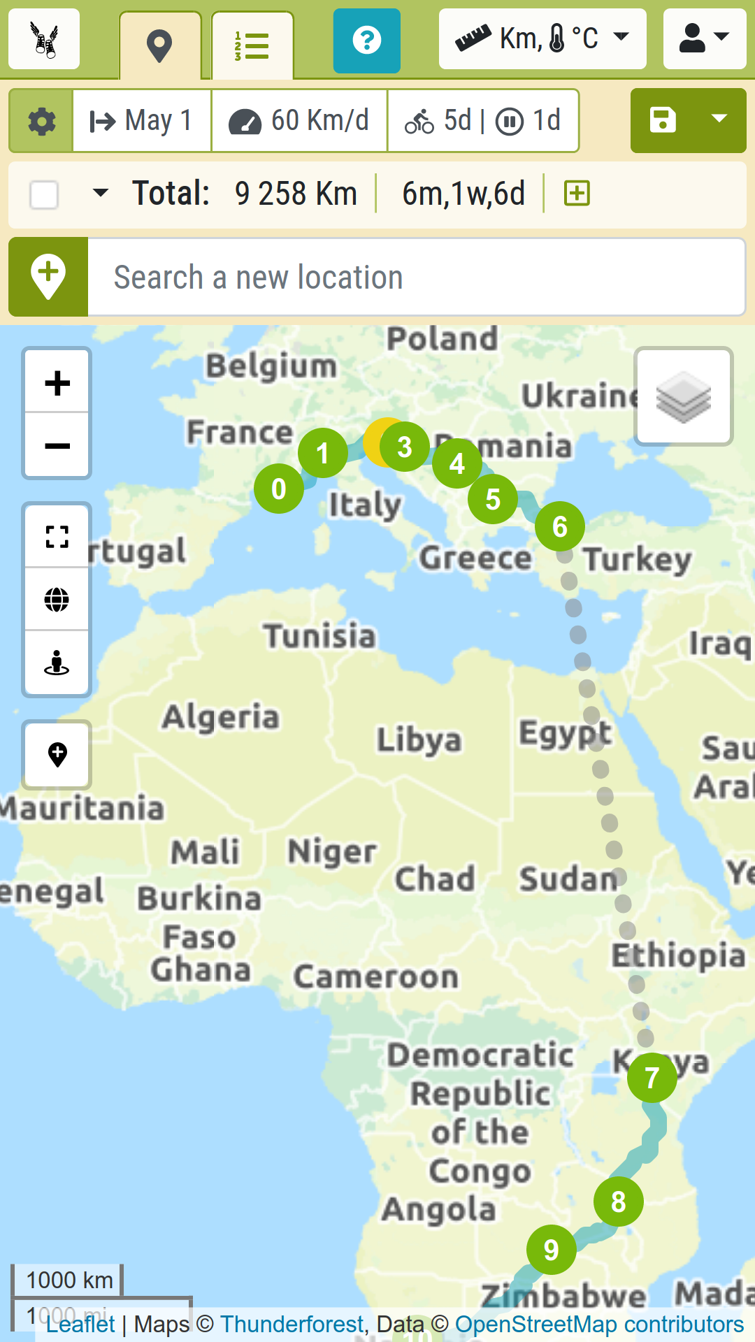
Determine your itinerary
- Easily draw your route with a few clicks on a map
- Insert lifts by bus, ferry, and all means
- Time, distance, speed, elevation… get a whole load of metrics
Tune your own travelling style
- Customize your daily riding pace
- Specify regular rests
Designed for long distance bicycle touring
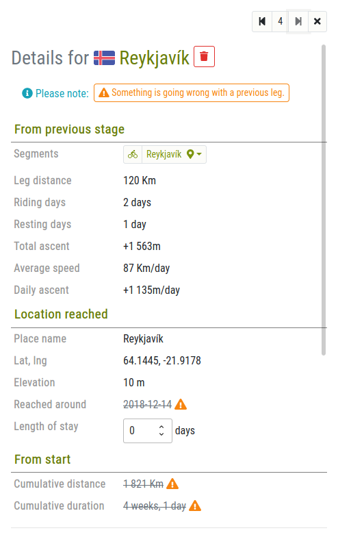
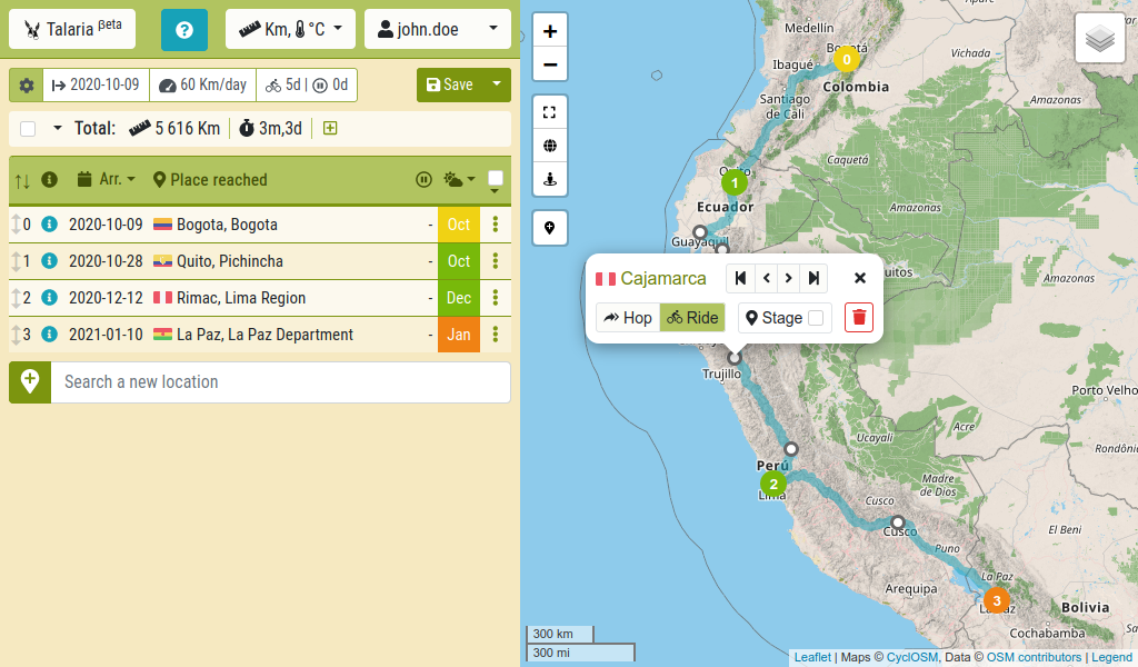
- Get a timetable based on your itinerary and settings.
- Plan stopovers in key locations
- Check an expectation of the climate you should meet on your way
Screenshots

What’s up?
- Good news: I broke my shoulder!It’s been a while since I last updated Talaria. (Almost three years, in fact.) Not for lack of ideas! I’ve got quite a long list of improvements I’d like to make. But life is just so busy, with work, daily routines, various hobbies and so many exciting projects!Sometimes, however, an unexpected event can turn everything… Lire la suite »Good news: I broke my shoulder!
- New release: Improved markers and moreThis new update of Talaria mainly focuses on the map.The route stages now appear in a cleaner way, and a new kind of markers allow designating any point of interest that will serve as a reference while plotting the itinerary.People using a mouse or similar pointing device will also be pleased to see their user… Lire la suite »New release: Improved markers and more
- New release: Route stages and other new featuresRecent developments on Talaria have demanded a lot of work, but I’m very glad to introduce a new feature which should significantly improve the user’s experience of planning cycling trips.See below how the distinction between simple waypoints and remarkable route stages will both provide a better overview of your trans-continent trips and allow you to… Lire la suite »New release: Route stages and other new features