Recent developments on Talaria have demanded a lot of work, but I’m very glad to introduce a new feature which should significantly improve the user’s experience of planning cycling trips.
See below how the distinction between simple waypoints and remarkable route stages will both provide a better overview of your trans-continent trips and allow you to finely tune shorter tours. I already can’t do without this functionality any more!
In addition, this new upgrade also brings appreciable improvements with how pop-up messages behave, as well as additions to the helps tools, revision of some user interface elements, and of course, as always, various visual refinements and bugs fixing.
Simple waypoints vs remarkable stages
When defining your itinerary, the default route provided by Talaria may not immediately satisfy your preferences. Instead of what a program identifies as the more suitable route for a cyclist, you may for instance wish to follow the sea shore, or go over this crazy mountain pass. So you’ll add one or more intermediary waypoints on your itinerary, in order to determine your way with more precision.
Previously, adding these waypoints would have also added more lines in the route step’s list which you probably didn’t want to see detailed, and subdivide the metrics provided for your route.
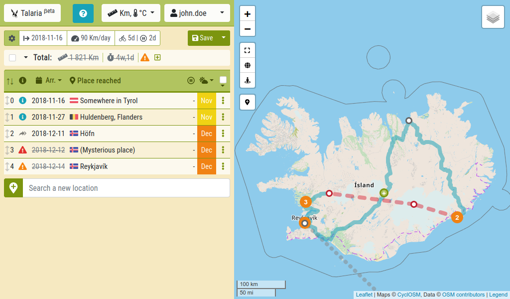
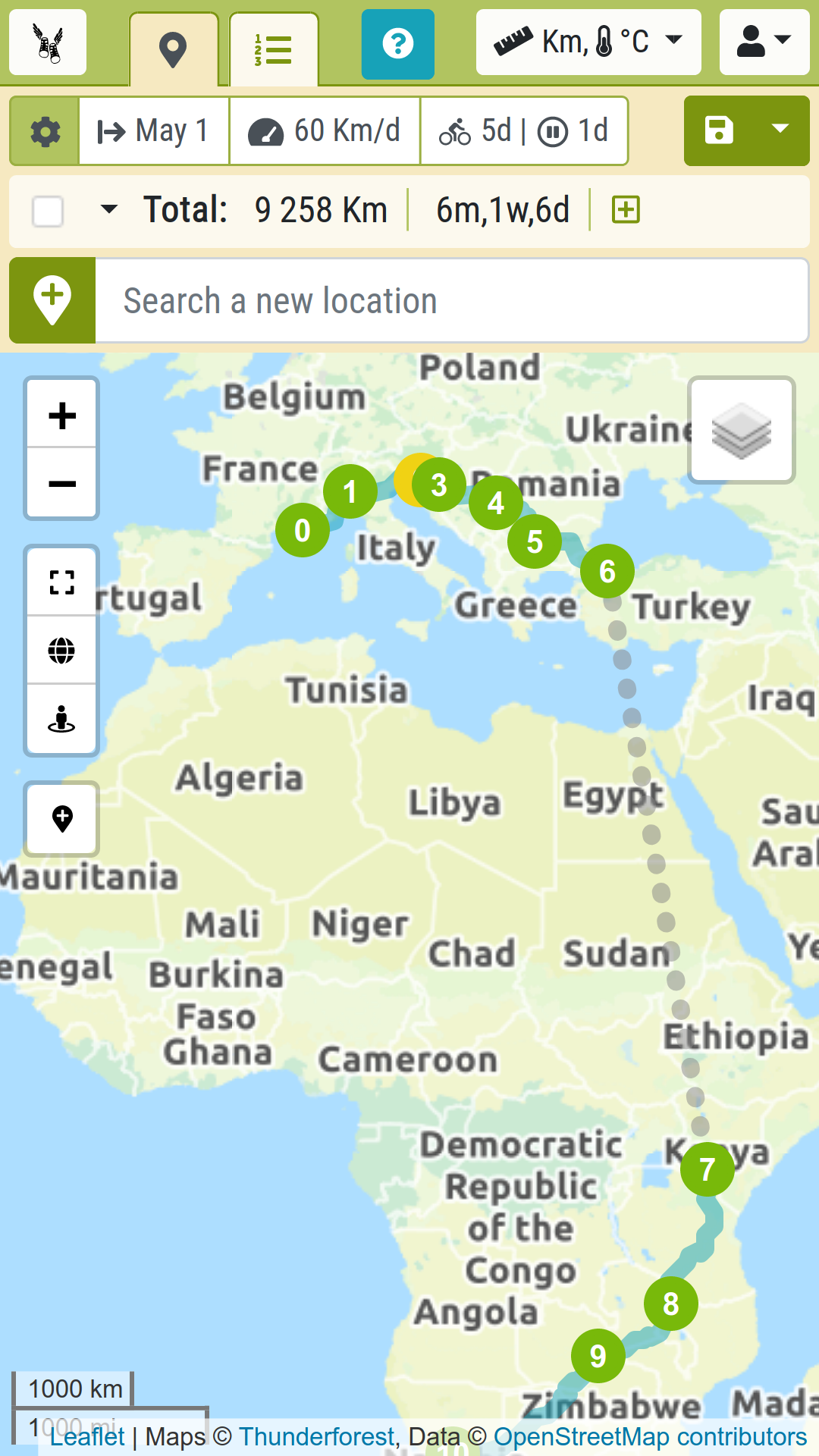
However, Talaria now allows you distinguishing remarkable stages from intermediary waypoints in your route. Just check or uncheck the « stage » feature of a waypoint, and this will toggle between the two options. Only remarkable stages will be listed in the route table, and only these also will be highlighted on the map with and index number as well as coloured circle (whereas intermediary waypoints will display as smaller white circles).
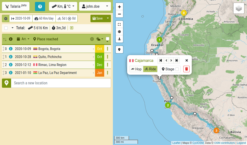
Furthermore, the distance, elevation gain and other metrics that are displayed for a route stage will now merge and cumulate all the intermediate sections from the previous major stage (including the intermediary waypoints). This results in more relevant statistics as well as a more tidy and readable display of data.
For the planning of your long international trips, you will mostly gain in clarity. But this new feature also marks a major step in the milestones that I’ve been following in the recent updates : providing more accurate tools for a precise planning of shorter tours. Potentially, you may now define itineraries on a day by day basis, using stages as markers of the end of a day.
This functionality is still at a very unripe state for now. I decided to release it at an early stage of development in order to benefit from your feedback in the process of constructing something comprehensive and consistent.
My aim is to make day-by-day planning as intuitive and handy as what Talaria has been offering so far for drawing the mainlines of big continental trips. Feel free to leave your views, ideas and questions in the comments section of this page.
For now, the design of this new feature brings the following changes to the user interface :
On the map:
- Simple waypoints now appear as smaller white circles. Only stages are numbered.
- The pop-up (which is triggered when clicking a waypoint) allows toggling either a waypoint is a major stage or not.
- Clicking or dragging the wayline will add simple waypoints.
In the table:
- Only stages are listed.
- Metrics are given for the whole route leg from previous stage, including intermediary waypoints.
- Actions on a stage row (such as selection, removal…) now also affects the intermediate waypoints of the leg.
- Reorganizing stages order removes intermediate waypoints.
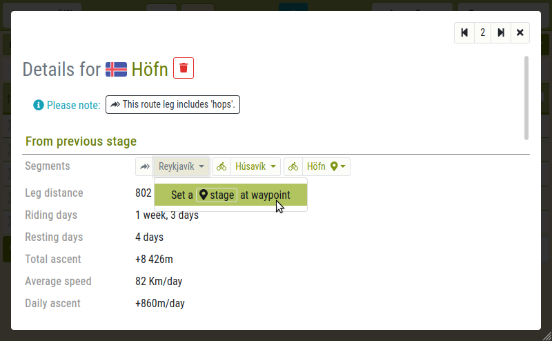
In the detailed view of a stage:
- Detailed view are available for stage waypoints only.
- Metrics are now given for the whole stage leg, merging the intermediary waypoint sections in the counts.
- Segments of the route leg (between intermediary waypoints) are listed in « From previous stage » section. A few actions are available for each waypoint.
Finally, those changes come with a revised geekspeak :
- What used to be called « steps » are now designated as « waypoints », and some of them can be « stages ».
- The stretch of road between two waypoints is now called a « route section » (or just « section »), whereas the stretch between two stages is designated as (route) « leg ».
New help tools
As in almost every update of Talaria, I added or improved help tools and user assistance:
- The button which used to start a slide-show tutorial (located in the nav bar) now offers a more varied panel of helps.
- A glossary now explains the terms used in the app.
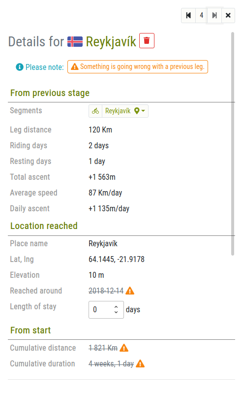
- The « Step type » column in the table is replaced with an « info » column, aiming to catch the attention of the user on problems or things to keep in mind.
- The detailed view of a stage also displays such notices, at the top of it.
In the same effort, pop-ups were improved:
- They now display at the bottom of viewport, which makes them less obtrusive.
- Their auto-close timeout may now be restarted (when hovering them with the cursor) or cancelled (by clicking them).
- Removing waypoints from the route now triggers a cancellation pop-up.
Other changes
- The removal of waypoints may now be cancelled, through a dedicated pop-up.
- Detailed views of a waypoint were revised.
- Export of the route to GPX format is back and slightly improved.
- The « Step type » (hop vs ride) is now called « section travel mode » (or simply « mode »).
- Many other visual refinements and bug fixes